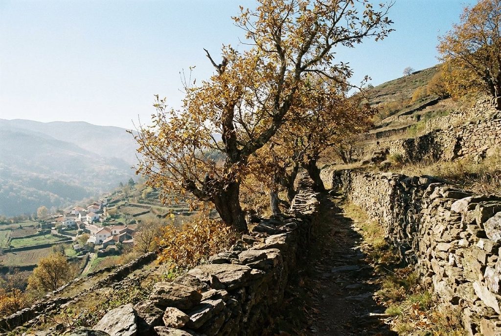
Old mule paths still link the Alpujarra's villages, and the GR 7 strings many of them into one long route. The walking is steep, varied and best in spring or autumn.
- Area: Alpujarra-wide
- From Granada: Forty-five minutes to two hours
- Best months: April, May, October, November
- Bring: Broken-in boots, two litres of water, map
Field note: Summer heat in the lower valleys is the main hazard, not the mountains. Start at first light, carry more water than you think, and finish before the afternoon.
Before roads reached the Alpujarra, people and goods moved between the villages on foot and by mule. Those paths are still there: stone-edged tracks that cut between terraces, cross rivers on narrow bridges and climb from one village to the next. They make the region one of the best in southern Spain for walking from place to place, with a village, a fountain and somewhere to eat at the end of most stages.
The GR 7 across the Alpujarra
The GR 7 is a long-distance path that crosses southern Spain on its way through Europe, and one of its finest sections runs east-west along the Alpujarra. It enters the region at Lanjarón and climbs through Cáñar and Soportújar to the Poqueira gorge, passing Pampaneira and Bubión. It continues east through Pitres, Pórtugos and Busquístar to Trévelez, then on to Juviles, Bérchules and the eastern Alpujarra.
Most stages run between five and seven hours, linking two or three villages each day. The path is waymarked with red and white stripes, but marks can be sparse, faded or hidden by new tracks, so carry a map or a downloaded route. Stages often include long climbs and descents; a day with a thousand metres of ascent and descent is normal.
Nobody expects you to cover every stage. Two or three days between Lanjarón and Trévelez give a good sense of the whole. For a starting point, see Lanjarón and Órgiva.
Shorter walks between villages
Many of the best walks are short. The path from Pampaneira up to Bubión and Capileira, described in the Poqueira villages, takes a morning. Loops from Capileira down to the Río Poqueira and back take half a day. From Pitres, the cluster of small villages called La Taha is linked by short paths through chestnut woods and terraces, and you can walk a circuit of them in a few hours.
See also: Trévelez, high and cured
Many paths follow acequias, the irrigation channels that run along the contour, and these give some of the easiest, flattest walking in the region. The history of these channels is told in the acequias and terraces.
Buses link the main villages, which makes one-way walks possible: walk to the next village and ride back. Services are few, especially on Sundays and holidays, so check the timetable before you set out.
Seasons
Spring, from April to early June, is the best time to walk. Rivers run full with snowmelt, the terraces are green, fruit trees flower and the temperatures suit long days. Autumn, from late September to November, is the other good season, with chestnuts falling and the poplars turning yellow along the rivers.
Summer is hot. In July and August the lower valleys, around Órgiva and along the Guadalfeo, can be very hot by late morning, and shade on the path is patchy. Walk early, keep to higher ground and finish by early afternoon.
Winter is often clear and bright, and the lower paths can be pleasant. But snow can fall on the higher villages and close paths above them, and days are short. The high mountains are a different matter, covered in the Mulhacén story.
Water, heat and safety
- Most villages have public fountains. Water from fountains marked as drinking water is generally safe; do not drink from acequias, streams or fountains marked as not suitable.
- Carry at least two litres of water on any stage, and more in summer.
- Paths can be loose, stony and steep. Walking poles help on the descents.
- Mobile coverage is patchy in the deeper valleys. Tell someone your route.
- Many paths cross farmland. Close gates behind you, keep dogs on a lead near livestock, and leave the acequias and terraces alone.
- Forest fires are a risk in summer. Do not light fires or drop cigarette ends, and check for restrictions in dry spells.
Planning
Allow more time than distances suggest; the climbs make every stage slow. Plan where you will sleep before you set out, as villages have few beds, and some places close outside the main seasons. Check bus times, opening seasons and any path closures before you go.