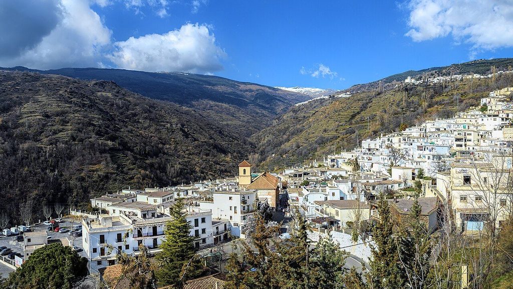
Three white villages climb one side of the Poqueira gorge, each a little higher and colder than the last, joined by the road and by older paths.
- Area: Poqueira
- From Granada: About ninety minutes by car
- Best months: April to June, October
- Bring: Grippy shoes, a layer, water bottle
Field note: The lanes are steep, stepped and often wet where water runs down them. Park at the edge of each village and walk in; the upper streets are not for cars.
The Barranco de Poqueira is a deep valley cut into the south face of the Sierra Nevada, and three villages hang on its western side. Pampaneira sits lowest, at roughly 1,050 metres. Bubión is above it, and Capileira, at around 1,440 metres, is the highest and the last before the road gives out into the national park. From the road below they read as white blocks stacked on terraces, with the grey bulk of the high sierra filling the head of the valley.
The three are close enough to see each other and different enough to visit all of them. A day is enough to walk between them; two days let you take the side paths down to the river.
How the houses are built
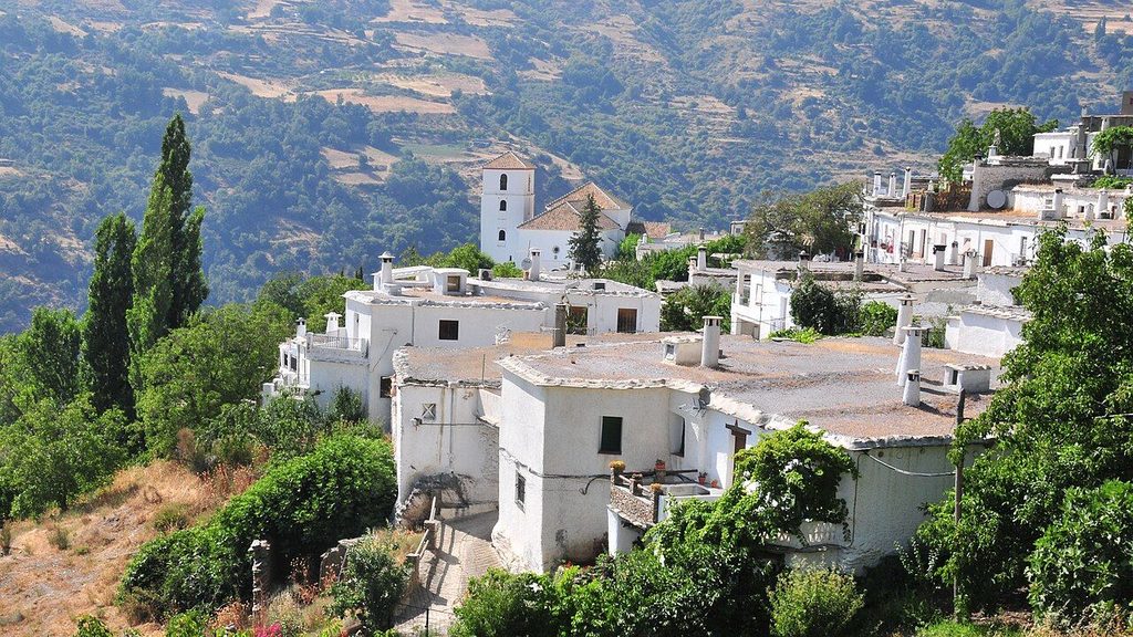
The Poqueira villages keep a way of building that runs through the whole Alpujarra and is easier to read here than almost anywhere else. Walls are thick, of stone, and whitewashed. Roofs are flat, laid on chestnut beams and slabs of slate, then sealed with launa, a grey magnesium-rich clay that packs down to keep rain out. The roofs, called terraos, are used: for drying peppers and fruit, for hanging washing, for sitting in the evening sun.
The chimneys are the detail that most people photograph. They are round or square stacks topped with a flat stone cap, sometimes with a smaller stone on top of that, so smoke can leave and rain cannot get in. Look also for the tinaos, covered passages where a house has been built across a lane on beams, leaving a dark tunnel below that once sheltered animals and people from sun and snow.
Much of this layout goes back to the Berber settlers of the Middle Ages, and the clustered, stepped plan follows the slope rather than any grid. The older history of the valley and the people who built it is set out in the story of the acequias and terraces.
Pampaneira
Pampaneira is the first village you reach and the busiest. Its main square, with the church of Santa Cruz on one side, fills with cars and coaches in the middle of the day. Walk uphill from the square and the crowds thin quickly. Water runs in open gutters down the centre of several lanes, fed from the channels above the village, and fountains turn up at corners.
The village is known for weaving, especially the striped rugs called jarapas, and you will see them hung outside doorways. Prices and quality vary; take your time.
Bubión
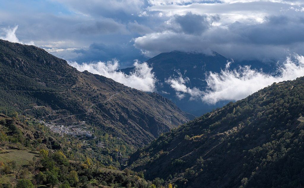
Bubión is the quietest of the three and the one people tend to drive through. That is its point. The lanes below the church are among the best preserved in the valley, with rows of capped chimneys and roof terraces stepping down the slope. A small house museum in the village shows how a traditional Alpujarra home worked, from the stable on the ground floor to the drying space on the roof; check opening days before you go, as they change.
From the lower edge of Bubión you get a long view down the gorge and across to the far slope, where abandoned terraces still show as faint lines in the scrub.
See also: Mulhacén, the highest peak
Capileira
Capileira is the highest of the three and the base for walks and climbs into the high sierra. The upper village is a maze of whitewashed lanes; the lower part, along the road, has the car parks and the bus stop. A small museum in the village is dedicated to the nineteenth-century writer Pedro Antonio de Alarcón, whose book on the Alpujarra helped bring outside attention to the region; again, check its hours first.
Above Capileira the road continues as a track into the Sierra Nevada National Park. Private cars are not allowed beyond a certain point, and in the warmer months a park shuttle runs from the village up the high track. Its season, timetable and booking rules change from year to year, so check before you go. The shuttle is the usual start for the long day to the summit of Mulhacén.
Walking between the villages
The road links the three villages in a series of bends, but old mule paths link them more directly. The path from Pampaneira up to Bubión climbs through terraces and chestnut trees and takes about an hour for most walkers. From Bubión to Capileira is shorter. Coming down is harder on the knees than going up, and the stones polish smooth in places.
From Capileira, paths drop to the Río Poqueira, where old stone bridges cross the water and a small abandoned hydroelectric settlement sits further up the valley. A loop down to the river and back is a half-day walk with a steep climb at the end. Waymarking is reasonable but not perfect; carry a map or a downloaded track. Longer routes across the region, including the GR 7, are covered in walking the Alpujarra.
Practical notes
- The road up from Órgiva is narrow and winding. The map distance flatters the bends, so budget extra time.
- Buses run from Granada to the Poqueira villages a few times a day; check the current timetable.
- In winter, Capileira can see snow and ice on its lanes. In high summer the middle of the day is hot even at this height; walk early.
- Weekends and Spanish holidays bring day visitors from Granada and the coast. Weekdays are quieter.